FAA INFORMATION EFFECTIVE 17 APRIL 2025
Location
| FAA Identifier: | HFD |
| Lat/Long: | 41-44-12.2000N 072-38-58.0000W
41-44.203333N 072-38.966667W
41.7367222,-72.6494444
(estimated) |
| Elevation: | 18.3 ft. / 5.6 m (surveyed) |
| Variation: | 15W (1995) |
| From city: | 3 miles SE of HARTFORD, CT |
| Time zone: | UTC -4 (UTC -5 during Standard Time) |
| Zip code: | 06114 |
Airport Operations
| Airport use: | Open to the public |
| Activation date: | 04/1940 |
| Control tower: | yes |
| ARTCC: | BOSTON CENTER |
| FSS: | BRIDGEPORT FLIGHT SERVICE STATION |
| NOTAMs facility: | HFD (NOTAM-D service available) |
| Attendance: | APR-NOV 0700-2100, DEC-MAR 0700-1900 |
| Wind indicator: | lighted |
| Segmented circle: | yes |
| Lights: | WHEN ATCT CLSD, ACTVT REIL RWYS 02 & 20; HIRL RWY 02/20 - CTAF. PAPI RWY 02 & 20 OPR CONSLY. |
| Beacon: | white-green (lighted land airport)
Operates sunset to sunrise. |
| Landing fee: | no, LDG FEE FOR BUS/CORPORATE & REVENUE PRODUCING ACFT. |
| Airline operations: | ARPT CLSD TO ACR OPNS. |
Airport Communications
| CTAF: | 119.6 |
| UNICOM: | 122.95 |
| ATIS: | 126.45 |
| WX ASOS: | PHONE 860-527-5837 |
| BRAINARD GROUND: | 121.6 121.6 ;WHEN TWR CLSD [0600-0000] |
| BRAINARD TOWER: | 119.6 248.2 [0600-0000] |
| BRADLEY APPROACH: | 127.8 |
| BRADLEY DEPARTURE: | 127.8 |
| CLEARANCE DELIVERY: | 121.6 121.6 ;WHEN TWR CLSD |
| STELA STAR: | 125.35 |
| WX AWOS-AV at CT71 (7 nm W): | 129.825 |
| WX AWOS-3PT at 4B8 (10 nm W): | 119.175 (860-351-5362) |
| WX ASOS at BDL (12 nm N): | 118.15 (860-386-3480) |
| WX ASOS at MMK (16 nm SW): | 134.925 (203-639-9405) |
Nearby radio navigation aids
| VOR radial/distance | | VOR name | | Freq | | Var |
|---|
| HFDr334/7.3 | | HARTFORD VOR/DME | | 114.90 | | 13W |
| MADr017/25.4 | | MADISON VOR/DME | | 110.40 | | 13W |
| BAFr187/25.7 | | BARNES VORTAC | | 113.00 | | 14W |
| ORWr304/31.1 | | NORWICH VOR/DME | | 110.00 | | 14W |
| CTRr171/35.9 | | CHESTER VOR/DME | | 115.10 | | 13W |
| GONr326/36.3 | | GROTON VOR/DME | | 110.85 | | 14W |
| PUTr264/38.3 | | PUTNAM VOR/DME | | 117.40 | | 14W |
Airport Services
| Fuel available: | 100LL JET-A |
| Parking: | hangars and tiedowns |
| Airframe service: | MAJOR |
| Powerplant service: | MAJOR |
| Bottled oxygen: | NONE |
| Bulk oxygen: | NONE |
Runway Information
Runway 2/20
| Dimensions: | 4417 x 150 ft. / 1346 x 46 m |
| Surface: | asphalt/grooved, in fair condition |
| Weight bearing capacity: | | Single wheel: | 30.0 | | Double wheel: | 43.0 | | Double tandem: | 70.0 |
|
| Runway edge lights: | high intensity |
| RUNWAY 2 | | RUNWAY 20 |
| Latitude: | 41-43.898288N | | 41-44.616695N |
| Longitude: | 072-38.988637W | | 072-38.837732W |
| Elevation: | 11.0 ft. | | 18.3 ft. |
| Traffic pattern: | left | | left |
| Runway heading: | 024 magnetic, 009 true | | 204 magnetic, 189 true |
| Displaced threshold: | 411 ft. | | 560 ft. |
| Markings: | nonprecision, in good condition | | nonprecision, in good condition |
| Visual slope indicator: | 4-light PAPI on left (4.00 degrees glide path) | | 4-light PAPI on right (4.00 degrees glide path)
RWY 20 PAPI UNUSBL BYD 7 DEGS L OF RCL. |
| Runway end identifier lights: | yes | | yes |
| Touchdown point: | yes, no lights | | yes, no lights |
| Instrument approach: | LDA | | |
| Obstructions: | 100 ft. trees, 1263 ft. from runway, 300 ft. left and right of centerline, 10:1 slope to clear
3 FT GND, 0 FT DSTC, 150 FT R. | | 80 ft. trees, 238 ft. from runway, 252 ft. right of centerline, 1:1 slope to clear
27 FT BERM, 0-199 FT DSTC, 171-57 FT L. |
Runway 11/29
| Dimensions: | 2314 x 71 ft. / 705 x 22 m |
| Surface: | asphalt, in good condition |
| Weight bearing capacity: | |
| Runway edge lights: | high intensity |
| RUNWAY 11 | | RUNWAY 29 |
| Latitude: | 41-44.051425N | | 41-43.992375N |
| Longitude: | 072-39.454805W | | 072-38.952272W |
| Elevation: | 13.9 ft. | | 12.0 ft. |
| Traffic pattern: | left | | left |
| Runway heading: | 114 magnetic, 099 true | | 294 magnetic, 279 true |
| Displaced threshold: | no | | 265 ft. |
| Markings: | basic, in good condition | | basic, in good condition |
| Runway end identifier lights: | no | | no |
| Touchdown point: | yes, no lights | | yes, no lights |
| Obstructions: | 56 ft. trees, 550 ft. from runway, 18 ft. right of centerline, 6:1 slope to clear | | 88 ft. trees, 714 ft. from runway, 175 ft. left and right of centerline, 5:1 slope to clear
APCH RATIO 11:1 TO DTHR. |
Helipad H1
| Dimensions: | 70 x 77 ft. / 21 x 23 m |
| Surface: | asphalt, in good condition |
| Runway edge lights: | medium intensity |
| Latitude: | 41-44.625333N | | |
| Longitude: | 072-38.942833W | | |
| Elevation: | 16.0 ft. | | |
| Traffic pattern: | left | | left |
| Markings: | none | | |
Helipad H2
| Dimensions: | 44 x 44 ft. / 13 x 13 m |
| Surface: | asphalt, in excellent condition |
| Runway edge lights: | medium intensity |
| Latitude: | 41-44.355167N | | |
| Longitude: | 072-39.016667W | | |
| Elevation: | 14.0 ft. | | |
| Traffic pattern: | left | | left |
| Markings: | none | | |
Runway NE/SW
| Dimensions: | 2309 x 150 ft. / 704 x 46 m |
| Surface: | turf |
| RUNWAY NE | | RUNWAY SW |
| Traffic pattern: | left | | left |
| Obstructions: | 68 ft. trees, 624 ft. from runway, 195 ft. left and right of centerline, 9:1 slope to clear | | 91 ft. trees, 1885 ft. from runway, 20:1 slope to clear |
Airport Ownership and Management from official FAA records
| Ownership: | Publicly-owned |
| Owner: | CONNECTICUT AIRPORT AUTHORITY
SUITE 160, 334 ELLA GRASSO TURNPIKE
WINDSOR LOCKS, CT 06096
Phone 860-386-6000 |
| Manager: | PELLEGRINO, ROBERT
239 MAXIM ROAD
HARTFORD, CT 06114
Phone 860-982-2443 |
Additional Remarks
| - | BIRDS & DEER ON & INVOF ARPT. |
| - | ARPT LCTD IN NOISE SENSITIVE AREA. POPULATED AREAS TO SOUTH & WEST SHOULD BE AVOIDED. APCH/DEP OVR RIVER WHEN PSBL. SEE BRAINARD TWR LTRS TO AIRMEN. |
| - | VOLUNTARY COMPLIANCE REQSTD - NO TGL & PRACTICE INST APCH MON THRU SAT 2200-0600 & SUN 2200-0900. |
| - | TURF NE/SW RWY CLSD DURG WINTER MONTHS FM NOV 2 TO APR 30 EXC FOR SKI-EQUIPPED ACFT & HEL TRNG. |
| - | CTN HFD IS LCTD ON W SIDE OF RIVER. CLSD ARPT 1 MILE ENE OF HFD ON E SIDE OF RIVER. |
| A52-H1 | HNGR (26 FT HIGH AT 290 DEGS WEST) 234 FT FROM HELI. |
Instrument Procedures
NOTE: All procedures below are presented as PDF files. If you need a reader for these files, you should download the free Adobe Reader.NOT FOR NAVIGATION. Please procure official charts for flight.
FAA instrument procedures published for use from 17 April 2025 at 0901Z to 15 May 2025 at 0900z.
STARs - Standard Terminal Arrivals |
|---|
| STELA ONE | |
2 pages:
[1] [2] (305KB) |
IAPs - Instrument Approach Procedures |
|---|
| RNAV (GPS) RWY 02 | |
download (243KB) |
| LDA RWY 02 | |
download (316KB) |
| VOR-A | |
download (245KB) |
| RIVER VISUAL RWY 02 | |
download (169KB) |
| NOTE: Special Alternate Minimums apply | |
download (129KB) |
Departure Procedures |
|---|
| COASTAL NINE | |
2 pages:
[1] [2] (295KB) |
| NOTE: Special Take-Off Minimums/Departure Procedures apply | |
download (388KB) |
Other nearby airports with instrument procedures:
4B8 - Robertson Field Airport (10 nm W)
KBDL - Bradley International Airport (12 nm N)
KMMK - Meriden Markham Municipal Airport (16 nm SW)
KIJD - Windham Airport (21 nm E)
KSNC - Chester Airport (22 nm S)
|
|

Road maps at:
MapQuest
Bing
Google
| Aerial photo |
|---|
WARNING: Photo may not be current or correct
 Photo taken 25-Nov-2023
looking southwest.
Photo taken 25-Nov-2023
looking southwest.
Do you have a better or more recent aerial photo of Hartford-Brainard Airport that you would like to share? If so, please send us your photo.
|
| Sectional chart |
|---|
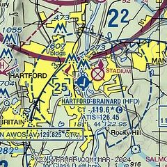
|
CAUTION: Diagram may not be current
 Download PDF
of official airport diagram from the FAA
| Airport distance calculator |
|---|
|
|
| Sunrise and sunset |
|---|
|
Times for 30-Apr-2025
| | Local
(UTC-4) | | Zulu
(UTC) |
|---|
| Morning civil twilight | | 05:19 | | 09:19 |
| Sunrise | | 05:49 | | 09:49 |
| Sunset | | 19:46 | | 23:46 |
| Evening civil twilight | | 20:16 | | 00:16 |
|
| Current date and time |
|---|
| Zulu (UTC) | 30-Apr-2025 17:22:27 |
|---|
| Local (UTC-4) | 30-Apr-2025 13:22:27 |
|---|
|
| METAR |
|---|
| KHFD | 301653Z 31011G21KT 10SM CLR 18/03 A2996 RMK AO2 SLP145 T01830028
|
KBDL
12nm N | 301651Z 31011G21KT 10SM FEW200 FEW250 18/02 A2996 RMK AO2 PK WND 31026/1615 SLP146 T01830022
|
KMMK
16nm SW | 301653Z AUTO 32012G24KT 10SM CLR 21/01 A2996 RMK AO2 SLP145 T02060006
|
|
| TAF |
|---|
KBDL
12nm N | 301418Z 3014/0118 32015G27KT P6SM FEW250 FM302200 32012KT P6SM SKC FM010300 00000KT P6SM SKC FM011600 16004KT P6SM SCT100
|
|
| NOTAMs |
|---|
NOTAMs are issued by the DoD/FAA and will open in a separate window not controlled by AirNav.
|
|


