FAA INFORMATION EFFECTIVE 23 JANUARY 2025
Location
| FAA Identifier: | E26 |
| Lat/Long: | 32-07-51.8820N 103-09-17.4620W
32-07.864700N 103-09.291033W
32.1310783,-103.1548506
(estimated) |
| Elevation: | 3118 ft. / 950.4 m (surveyed) |
| Variation: | 09E (1985) |
| From city: | 3 miles NE of JAL, NM |
| Time zone: | UTC -7 (UTC -6 during Daylight Saving Time) |
| Zip code: | 88252 |
Airport Operations
| Airport use: | Open to the public |
| Activation date: | 10/1953 |
| Control tower: | no |
| ARTCC: | FORT WORTH CENTER |
| FSS: | ALBUQUERQUE FLIGHT SERVICE STATION |
| NOTAMs facility: | ABQ (NOTAM-D service available) |
| Attendance: | UNATNDD |
| Wind indicator: | lighted |
| Segmented circle: | yes |
| Lights: | ACTVT PAPI RWY 01 & 19; MIRL RWY 01/19 - CTAF. MIRL RWY 01/19 PRESET LOW INTST - INCR INTST - CTAF. |
| Beacon: | white-green (lighted land airport)
Operates sunset to sunrise. |
Airport Communications
Nearby radio navigation aids
| VOR radial/distance | | VOR name | | Freq | | Var |
|---|
| INKr005/16.0 | | WINK VORTAC | | 112.10 | | 11E |
| HOBr158/31.0 | | HOBBS VORTAC | | 111.00 | | 11E |
Airport Services
Runway Information
Runway 1/19
| Dimensions: | 4704 x 60 ft. / 1434 x 18 m |
| Surface: | asphalt, in fair condition |
| Weight bearing capacity: | | PCN 4 /F/C/Y/T | | Single wheel: | 23.0 |
|
| Runway edge lights: | medium intensity |
| RUNWAY 1 | | RUNWAY 19 |
| Latitude: | 32-07.514333N | | 32-08.256333N |
| Longitude: | 103-09.422500W | | 103-09.156167W |
| Elevation: | 3097.0 ft. | | 3104.0 ft. |
| Traffic pattern: | left | | left |
| Runway heading: | 008 magnetic, 017 true | | 188 magnetic, 197 true |
| Markings: | basic, in fair condition | | basic, in fair condition |
| Visual slope indicator: | 2-light PAPI on left (3.03 degrees glide path) | | 2-light PAPI on left (2.83 degrees glide path) |
| Touchdown point: | yes, no lights | | yes, no lights |
| Obstructions: | 3 ft. brush, 201 ft. from runway, 120 ft. right of centerline
+2-3 FT BRUSH 0-200 FT FM THR 115-250 FT R & 100 FT L OF CNTRLN. | | 12 ft. brush, 300 ft. from runway, 10 ft. left of centerline, 8:1 slope to clear
+1-2 FT BRUSH 0-200 FT FM THR 80 FT L OF CNTRLN. |
Runway 9/27
| Dimensions: | 2604 x 50 ft. / 794 x 15 m |
| Surface: | asphalt, in good condition |
| Weight bearing capacity: | | PCN 3 /F/B/Y/T | | Single wheel: | 12.0 |
|
| Operational restrictions: | +3-5 FT BRUSH 75-125 FT FM CNTRLN E SIDE. |
| RUNWAY 9 | | RUNWAY 27 |
| Latitude: | 32-07.866833N | | 32-07.788000N |
| Longitude: | 103-09.542167W | | 103-09.046000W |
| Elevation: | 3118.0 ft. | | 3097.0 ft. |
| Traffic pattern: | left | | left |
| Runway heading: | 092 magnetic, 101 true | | 272 magnetic, 281 true |
| Displaced threshold: | 40 ft. | | 45 ft. |
| Markings: | basic, in fair condition | | basic, in fair condition |
| Touchdown point: | yes, no lights | | yes, no lights |
| Obstructions: | 4 ft. brush, 201 ft. from runway
+4 FT FENCE 50 FT FM THR; +10 FT ROAD 40 FT FM THR. | | none
+4 FT FENCE 15 FT FM RWY END; +5 FT BRUSH 20 FT FM RWY END; +10 FT ROAD 10 FT FM THR. |
Airport Ownership and Management from official FAA records
| Ownership: | Publicly-owned |
| Owner: | LEA COUNTY
PO BOX 1106
HOBBS, NM 88241-1106
Phone 575-391-2934 |
| Manager: | CORY NEEDHAM
PO BOX 1106
HOBBS, NM 88241-1106
Phone 575-391-2934 |
Additional Remarks
| A30A-01 | +3 FT POSTS 145 FT FM THR ON CENTERLINE & 40 FT L & 110 FT R OF CNTRLN. |
| A30A-19 | +20 FT PUMP JACK 990 FT FM THR 185 FT L OF CNTRLN. |
| - | LINE OF SIGHT BTN RWYS NA. |
| - | OIL DRILLING ACT ON & INVOF ARPT. |
| - | FOR CD CTC FORT WORTH ARTCC AT 817-858-7584. |
Instrument Procedures
There are no published instrument procedures at E26.
Some nearby airports with instrument procedures:
KINK - Winkler County Airport (21 nm S)
KHOB - Lea County Regional Airport (34 nm N)
E11 - Andrews County Airport (34 nm E)
E01 - Roy Hurd Memorial Airport (35 nm S)
KODO - Odessa Airport-Schlemeyer Field (41 nm E)
|
|

Road maps at:
MapQuest
Bing
Google
| Aerial photo |
|---|
WARNING: Photo may not be current or correct

Do you have a better or more recent aerial photo of Lea County/Jal Airport that you would like to share? If so, please send us your photo.
|
| Sectional chart |
|---|
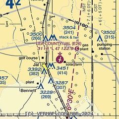
|
 Download PDF
of official airport diagram from the FAA
| Airport distance calculator |
|---|
|
|
| Sunrise and sunset |
|---|
|
Times for 06-Feb-2025
| | Local
(UTC-7) | | Zulu
(UTC) |
|---|
| Morning civil twilight | | 06:18 | | 13:18 |
| Sunrise | | 06:44 | | 13:44 |
| Sunset | | 17:30 | | 00:30 |
| Evening civil twilight | | 17:55 | | 00:55 |
|
| Current date and time |
|---|
| Zulu (UTC) | 06-Feb-2025 16:27:49 |
|---|
| Local (UTC-7) | 06-Feb-2025 09:27:49 |
|---|
|
| METAR |
|---|
KINK
21nm S | 061553Z AUTO 03003KT 9SM CLR 11/07 A3006 RMK AO2 SLP156 T01110067
|
KHOB
32nm N | 061550Z 34006KT 10SM CLR 19/M14 A3009
|
KE11
34nm E | 061615Z AUTO 26004KT 10SM CLR 17/M06 A3010 RMK AO2 T01691058
|
KODO
40nm E | 061553Z AUTO 00000KT 10SM CLR 17/09 A3008 RMK AO2 SLP152 T01670094 $
|
KGNC
41nm NE | 061615Z AUTO 30009KT 10SM CLR 19/M10 A3012 RMK AO2 T01891098
|
|
| TAF |
|---|
KINK
21nm S | 061120Z 0612/0712 VRB05KT 1SM BR BKN001 TEMPO 0612/0614 1/4SM FG FM061400 23007KT P6SM SKC FM070000 18007KT P6SM SKC
|
|
| NOTAMs |
|---|
NOTAMs are issued by the DoD/FAA and will open in a separate window not controlled by AirNav.
|
|


